Hemlock trail to Huckleberry trail and View Point #68
I finally had a weekend that had a free day, which seems to be rare these days, and seems to be making life crazy and stressful. I have been missing hiking and climbing... and just being outside.So I texted L during the week to see if she was free to go hiking on Sabbath (Saturday) and she said yes. I originally had planned on us going to Squak Mountain, but the boys were adamant that they wanted to bring their mountain bikes along. I knew that the trails in Bellingham were biker friendly because we saw them while hiking to Fairhaven Falls and Pine and Cedar Lakes. I proceeded to do some looking and decided that we were going to hike/bike to Raptor Ridge Overlook.
On Sabbath we went to Sabbath school and then came home to eat, change clothes and load the bikes. Eating and loading the bikes took longer then expected so we left my house later then I wanted to. Oh well such is life.
To get to the trail take I-5 and get off at exit 246. Go Right onto South Samish Way, continuing onto North Lake Samish Way, turn Right onto Old Samish Road, take a left onto Chuckanut Drive/WA-11S, then turn Left onto Hiline Road, then a slight Right onto Cleator Road.
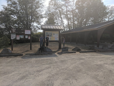
Once we finally arrived the parking lot was rather full, but there was one spot left that I could pull into. (There is no water available on this hike and there is one outhouse in the parking lot before the trail head.) The trails are clearly marked but I do recommend downloading the map to your phone.
.At this intersection L checked the map on her phone to make sure we were heading in the right direction. We stayed left. Cookie smelled something, and on the other side of the trail markers was this sign to tell you where the parking lot was.
H was so tired, grumpy and hurting because he really had pushed his bike all of the way. He was adamant that he couldn't go any further and that the "pine cones are hurting me." He also told us that his brakes kept locking up so my friend L undid his brakes so it would no longer happen.
Miss A at this point decided that she was done using the trekking poles and turned around to give them back to L since they belonged to her.
The Huckleberry trail becomes narrow, muddy and slippery. H was struggling again and L and Miss A waited for us. Cookie wanted us to go and was impatient with me taking a picture.
We did 4.8 miles with 880 feet elevation gain, had a lovely time despite the complaining in the beginning and we didn't get rained on!
On Sabbath we went to Sabbath school and then came home to eat, change clothes and load the bikes. Eating and loading the bikes took longer then expected so we left my house later then I wanted to. Oh well such is life.
To get to the trail take I-5 and get off at exit 246. Go Right onto South Samish Way, continuing onto North Lake Samish Way, turn Right onto Old Samish Road, take a left onto Chuckanut Drive/WA-11S, then turn Left onto Hiline Road, then a slight Right onto Cleator Road.
Once we finally arrived the parking lot was rather full, but there was one spot left that I could pull into. (There is no water available on this hike and there is one outhouse in the parking lot before the trail head.) The trails are clearly marked but I do recommend downloading the map to your phone.
After parking, the boys unloaded their bikes and reattached the front tires back onto the bikes, then we were off.
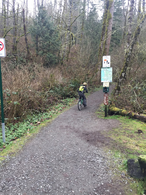
The trail starts off rather flat as you can see.
Miss A telling L that she was going to run beside him the whole way
We had barely started and H had to push his bike up the incline.
It turned flat again and we came upon this newly constructed bridge. I could tell it was new because you could still smell the fresh cut Cedar smell from the planks.
Miss A was so excited to run across the bridge! She literally screamed with joy.
.At this intersection L checked the map on her phone to make sure we were heading in the right direction. We stayed left. Cookie smelled something, and on the other side of the trail markers was this sign to tell you where the parking lot was.
We stayed left again.
There was hardly soul to be seen at first.
We came upon a small stream and another bridge.
Plus a small waterfall.
And another bridge.
The fun thing about this hike is that the wooden bridges are rather long for bridges on hikes that we have done.
So many sword ferns and so pretty.
At this point the boys were tired of biking uphill, and started complaining.
H was so tired at this point, and had pushed his bike up hill for the majority of the hike. Miss A had pretty much ran the way.
The kids wanted to climb on the boulder, but we were running behind and we needed to hurry so I told them no. Because there was no way at this rate that we were going to be done before sunset.
Poor H had to push his bike some more, and Miss A was upset that she was behind him because he was going so slow and she wanted to run. But H would yell at her to get behind him. Oh the joys of parenting!
At this point I decided that we were going to hike to Huckleberry trail and view point.
The trails are in very nicely maintained and are decently wide. Some sections of the trail were muddy, but not bad.
Cookie was concerned that the kids were ahead of us, and that I was not letting her catch up.
In the top picture the kids decided that they were going to convince me that we needed to turn around and go back to the car. I think we had only done about a mile. I will say that the boys had not done any riding since about May, and we haven't really done any hiking since August.
When you come to this junction stay left.
And further up the trail stay left at this junction.
There is a pretty wetland that you can stop and look at if you want to do so. I looked for wood ducks but didn't see any.
Stay to the right when you see this junction and follow the sign for huckleberry trail.
The trail pretty much is a dirt road. We saw a couple of very nice ladies on horses that we stopped and talked to. They let my daughter pet them and she was pretty happy about it.H was so tired, grumpy and hurting because he really had pushed his bike all of the way. He was adamant that he couldn't go any further and that the "pine cones are hurting me." He also told us that his brakes kept locking up so my friend L undid his brakes so it would no longer happen.
Miss A asked if she could use L's trekking poles.
L had changed his attitude and was much happier because his asthma was doing better and he had rested some while waiting for H to catch up.
After a while he rode a ways a head and stopped to wait for us. It was really flat so it made the for easy ridingMiss A at this point decided that she was done using the trekking poles and turned around to give them back to L since they belonged to her.
Stay left when you arrive at this Y. It does start climbing again, but it isn't bad.
You round the curve in the trail and you come upon these trees. It was pretty interesting to see.
I took this picture of Cookie while waiting for H again. I swear she is camera shy, she had been looking really cute with her ears up watching H.The Huckleberry trail becomes narrow, muddy and slippery. H was struggling again and L and Miss A waited for us. Cookie wanted us to go and was impatient with me taking a picture.
We let H pass us and get a head so we didn't have to keep waiting for him. I am so proud of him and how he kept on going even though he didn't want to. A little further up a dog met us on the trail. There was no owner that we could see and he was acting very aggressive to us and almost bit my daughter, even with me yelling that he go away. His owner finally showed up and lead him away so we could get to the view point. Which the view point had a bench and the view in our opinions was very disappointing. We immediately turned around and headed back down the trail. And yes we made sure that H's brakes were reattached.
The boys flew down the hill and left us in the dust just like I knew they would. We decided to take the trail that lead to Fairhaven falls instead of taking the trail that we had just hiked up.
I thought that the view above was very pretty.
And this section of the trail was very pretty as well.
At this Y go straight, you can go right and that takes you to the falls.
We arrived back at the rock and met up with the boys again. I gave L my car keys, so that when they arrived at it they could load their bikes while waiting for us. Plus I let Miss A climb on the boulder since I didn't when it passed it the first time; and we still had daylight and not that far from the trail head.We did 4.8 miles with 880 feet elevation gain, had a lovely time despite the complaining in the beginning and we didn't get rained on!
Until next time!


Comments
Post a Comment