Methow Community Trail and Trail off of Dripping Springs Road. 51 & 52
A couple of weekends ago B, L and I signed up to volunteer to check runners in at a race. We were supposed to have left on Friday but it turned out that L and I and were the only ones that went and ended up leaving on Saturday. We were extremely slow in getting over to the East side of the mountains because we stopped and toured a dam and gardens. We finally arrived at camp, checked in and set up, then headed to town because we decided that we wanted to go hiking and stretch our legs. But nothing too far away and not in the mountains since there was still snow and the weather couldn't make up it's mind if it was going to rain or be sunny.
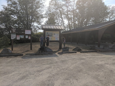
Our first hike that we went to was the Methow Community Trail. The trail was very flat and as the sign indicates in the picture below, was closed.
In the picture below you can see that the trail is still very flat, we were passed by some people on bikes because it is a multi-use trail.
This is what you do to keep the mosquitos off of you when mosquitos love you and you react to them. Put on a light jacket and use a visor to keep the hood on
On one plant we saw 3 leaves that had done this. I don't remember what it is called but the design it left in the leaf is really neat.
Our first hike that we went to was the Methow Community Trail. The trail was very flat and as the sign indicates in the picture below, was closed.
The detour lead us across the road. We actually turned around at the very beginning of the trail and were climbing into the car when the lady next to us said that it was a very nice trail and to give it a whirl.
The only thing that was neat about this trail was the flowers and the houses. I enjoy looking at houses and planning on what I want and don't want in a house plan, so seeing the houses along the trail was nice and gave me some ideas. I love the flowers on the east side of the mountains, they are so pretty and cheerful.In the picture below you can see that the trail is still very flat, we were passed by some people on bikes because it is a multi-use trail.
The views were pretty, and takes you along between property lines. I think we did 2 miles and headed back to the car. We were really bored.
On our way back to camp we decided to check out the trail off of Dripping Springs Road. This trail has an outhouse in the parking lot but no water.
It is a beautiful trail and very wide. It does take you behind some private property as well.
This trail is very flat as well.
The trail then turns into an access road.
In these 2 pictures you can see the weather starting to change.
On the other side of us it was blue sky and white clouds.
This section reminds me of the West side of the mountains.
This trail is also a multi-use trail as stated by the sign.
Shortly after this sign we came to this.........
Two of the giant "puddles" that we had to circumvent. They were huge, we walked on the side of them way off trail, and still ended up soaking wet.
Yay a dry section!!!
A picture of my soaking wet shoes. I had puddles of water in them for the rest of the hike.
Another puddle, but at least it wasn't a giant one.
There is a section of the river.
The views were/are very pretty.
The fence that you see pictured below is part of the WDFW land.
I took the picture of the sign below because it explains the landmarks of the valley.
This is what you do to keep the mosquitos off of you when mosquitos love you and you react to them. Put on a light jacket and use a visor to keep the hood on
This picture is my favorite, I love the colors and lupine.
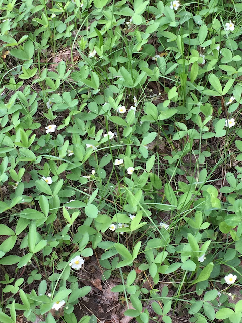
Wild strawberries.
On one plant we saw 3 leaves that had done this. I don't remember what it is called but the design it left in the leaf is really neat.
After I forget how many giant puddles, which were more like ponds, we turned around, the weather kept changing and it started raining, the trail seemed never ending and we were very tired of it. With both hikes combined I think we did around 5 miles. I can't think of much else to write because they were pretty boring to us. But we did get 2 hikes in and walking was nice instead of sitting some more after the long drive.
Until next time!


Comments
Post a Comment