Saddle Rock- Hike #70
This past weekend we went camping with my in-laws in Wenatchee Washington. We were going to go hiking on Sabbath but the we were all tired from getting into camp late, not sleeping well because....well because I forgot to pack the air mattress, sleeping pads and air pump. Needless to say none of us slept well. We made the decision to have a lazy day and sit around camp and to go hiking on Sunday after we checked out of the campground.
Sunday was not raining, which we were very thankful for: it was very grey, cloudy and blustery though.
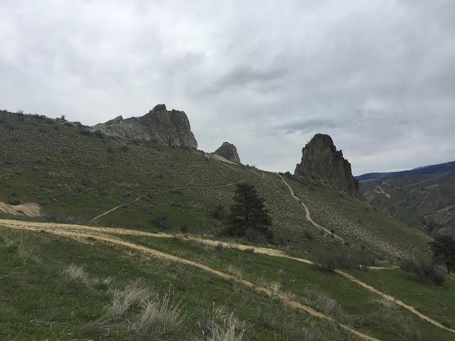
Once we had packed up and loaded everything into the trailer we headed to Saddle Rock. Now I have seen pictures of Saddle Rock and have wanted to hike it for a while, so I was wholly delighted to definitely be going.
The trail head was a short 15 minuet drive from the campground, which was really nice.
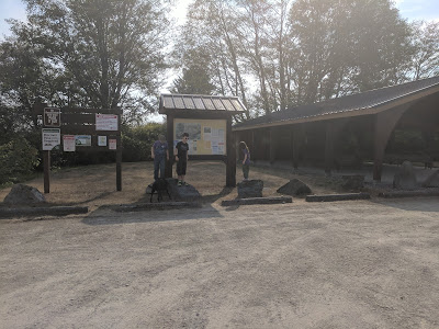
When we arrived the parking lot was rather full, but we managed to find a place to park. (The parking lot is rather large.) There is a large covered picnic area, pit toilets, (Make sure to close the lid after you use them to cut down on the smell.) water and a sign with a map and brochures of the different trails.
The trail starts out very wide and steep immediately.
You go under the power lines for a bit.
and rapidly get some wondrous views of Saddle Rock.
Miss A had to be our leader with Daddy. Which he out paced all of us, as usual.
The picture above shows where the entrance to the old copper mine was/is located. However it is now blockaded for safety concerns.
Abaft of the old copper mine is a sculpture with names of people or companies that have made donations to restore the native vegetation and trails.
The trail expeditiously levels out until you come to the curve near the rock on the right.
The trail expeditiously levels out until you come to the curve near the rock on the right.
It then becomes arduous, and is an agglomeration of bumps.
This is the view looking out over Wenatchee. The parking lot is to the right.
I don't remember what caught the attention of Miss A., B was waiting for us to verge upon him.
I interrupted my hiking to take in the views again and take a few pictures.
Such pleasing views.
The trails were very meandering and numerous.
No I did not tilt my camera to get the land to have this angle.
Almost to the top.
We finally arrived to the top.
I thought that this downed tree over the puddle was very alluring and took a picture of it.
We then hied over the ridge line to the rock.
We scrambled to the saddle and gazed out at the landscape because the kids desired to climb up it.
The arrowleaf balsam roots (balsamorhiza) were in full bloom and so spectacular. They are one of my favorite flowers, I also ascertained that there were tumbleweeds as well.
Apparently if you stick to the main trail is 2.3 miles with 915 feet elevation gain, we did a little over 3 miles according to my mother in law's watch that tracked how far we went. We had a wonderful camping trip and enjoyed this hike very much.
Until next time!


Comments
Post a Comment