Posts

Skagit Wildlife Area #37

Image
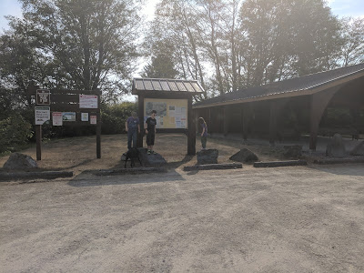
On Friday night I asked my daughter if we should go hiking on Sabbath, because I couldn't make up mind; she said yes. (I am so thankful that she loves to hike.) Today we headed to the Skagit Wildlife Area. I have been there before and wanted to take the kids to see and hear the birds and knew it was an easy 2.4 miles round trip hike. So we headed out to enjoy one more hike before the summer weather was gone. To get to the Skagit Wildlife Area take I-5 north or south bound and take exit 221 to Lake McMurray, head west onto Pioneer Highway to the round about and take the 2nd exit (Fir Island Rd). Follow the road until you need to make a left onto Wylie Road. Follow Wylie road until you come to a gravel road and a Washington Fish and Wildlife sign. Don't follow the curve and go left, you will have passed the Wild life area. The parking lot is very large and has a covered picnic area and a pit toilet bathroom. As we were leaving the parking area the kids ...

Spada Lake South Fork first Overlook #36

Image
Just so you know all of our hikes happen on a Saturday (Sabbath) because it is the only day in the week that I don't work and my friends don't work, which makes blog posts a once a week happening. But this last Sabbath we went to Spada Lake. We wanted to do an easy hike because on Sunday I had a half marathon, and my oldest and his friend wanted to bring their bikes. (My oldest has been trying to bring his bike on a hike forever.) So we loaded up the car and headed to Monroe to meet my friend R and his daughter. Once we met we headed straight to Sultan to meet my other friend and his daughter. It took forever to get through Sultan and I even took one of the short cut routes. I don't know why the last few Sabbaths it has taken so long but it has literally almost doubled our time in arriving at our destination. It tooks us almost 2 hours to get there. To get to Spada Lake take Highway 2 east, go through Sultan and when you come to the light for the Sultan Basin Road turn le...

Barclay Lake #35

Image
After church the kids, dog and my friend L, and another friend and his daughter went hiking to Barclay Lake. It is off of Highway 2 and is 4.4 miles round trip with only 500 feet elevation gain. We decided on Barclay because, well honestly after doing Mount Dickerman (which left a bad taste in our mouth if you couldn't tell) my friend L and I didn't want to do anything with any major elevation gain or switchbacks. To get to Barclay Lake head east on highway 2 to Baring. After milepost 41 the town of Baring is on the right hand side of Highway 2, turn left and go over the train tracks. The road quickly becomes a dirt road and you drive up through the power line towers. Go slow because it is a one lane road and there is no shoulder, is very dusty and some washboards. You will need a Northwest Forrest Pass which you can buy at REI or a Ranger Station. Once you get to the top there is a parking lot (small, we had to pull over on the road into the bushes) and an outhous...

Mount Dickerman #34

Image
Well I will start out saying that this is probably one of my least favorite hikes. I also recommend that if you are just getting into hiking don't do this one right away. The hike is 8.6 miles round trip, but there is 3,723 feet elevation gain in 4.3 miles. That is a lot of switchbacks! The parking lot does have a pit toilet and there is also an information sign that gives you details of the hike. Such as that the trees were planted in 1915 after a major fire came through the area and tells you about being able to see Glacier peak from the top. The trail starts out pretty flat from the parking lot and there is a register that we put our information on. (Which if there is a register I highly recommend putting your information down incase anything happens.) After hiking for awhile and looking at trees, a waterfall and a giant boulder. We stopped at this one spot that had devils club and found some water and decided to try my friends new water filter and fil...